


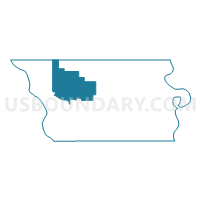
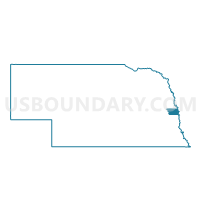
Precinct 8-48, Douglas County, Nebraska
About
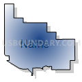
Outline

Summary
| Unique Area Identifier | 612866 |
| Name | Precinct 8-48 |
| County | Douglas County |
| State | Nebraska |
| Area (square miles) | 33.06 |
| Land Area (square miles) | 32.28 |
| Water Area (square miles) | 0.78 |
| % of Land Area | 97.63 |
| % of Water Area | 2.37 |
| Latitude of the Internal Point | 41.33816700 |
| Longtitude of the Internal Point | -96.26335800 |
Maps

Graphs
Select a template below for downloading or customizing gragh for Precinct 8-48, Douglas County, Nebraska


Neighbors
Neighoring Voting District (by Name) Neighboring Voting District on the Map
- Arlington Precinct, Washington County, NE
- Elkhorn Precinct, Dodge County, NE
- Precinct 6-56, Douglas County, NE
- Precinct 6-57, Douglas County, NE
- Precinct 6-58, Douglas County, NE
- Precinct 7-51, Douglas County, NE
- Precinct 8-12, Douglas County, NE
- Precinct 8-47, Douglas County, NE
- Precinct 8-49, Douglas County, NE
- Precinct 8-50, Douglas County, NE
- Precinct 8-7, Douglas County, NE
- Precinct 8-77, Douglas County, NE
- Precinct 8-86, Douglas County, NE
Top 10 Neighboring County Subdivision (by Population) Neighboring County Subdivision on the Map
- Omaha city, Douglas County, NE (408,958)
- Chicago precinct, Douglas County, NE (24,822)
- Jefferson precinct, Douglas County, NE (13,227)
- Platte Valley precinct, Douglas County, NE (3,079)
- Township 7, Washington County, NE (2,657)
- Waterloo precinct, Douglas County, NE (2,487)
- Elkhorn precinct, Douglas County, NE (1,218)
- Elkhorn township, Dodge County, NE (377)
Top 10 Neighboring Place (by Population) Neighboring Place on the Map
Top 10 Neighboring Unified School District (by Population) Neighboring Unified School District on the Map
- Elkhorn Public Schools, NE (31,042)
- Fremont Public Schools, NE (29,879)
- Bennington Public Schools, NE (7,532)
- Douglas County West Community Schools, NE (5,523)
- Arlington Public Schools, NE (3,375)
Top 10 Neighboring State Legislative District Upper Chamber (by Population) Neighboring State Legislative District Upper Chamber on the Map
- State Senate District 39, NE (68,359)
- State Senate District 23, NE (40,859)
- State Senate District 15, NE (36,691)
Top 10 Neighboring 111th Congressional District (by Population) Neighboring 111th Congressional District on the Map
Top 10 Neighboring Census Tract (by Population) Neighboring Census Tract on the Map
- Census Tract 75.12, Douglas County, NE (5,662)
- Census Tract 9638, Dodge County, NE (5,522)
- Census Tract 75.11, Douglas County, NE (4,654)
- Census Tract 503, Washington County, NE (4,435)
- Census Tract 73.18, Douglas County, NE (3,885)
- Census Tract 75.04, Douglas County, NE (3,161)
- Census Tract 75.05, Douglas County, NE (3,038)
- Census Tract 75.06, Douglas County, NE (2,169)
Top 10 Neighboring 5-Digit ZIP Code Tabulation Area (by Population) Neighboring 5-Digit ZIP Code Tabulation Area on the Map
- 68025, NE (30,376)
- 68116, NE (25,429)
- 68022, NE (16,422)
- 68007, NE (7,612)
- 68064, NE (3,376)
- 68069, NE (2,558)